Selwyn State of Emergency: Contact, Flood Maps & Updates
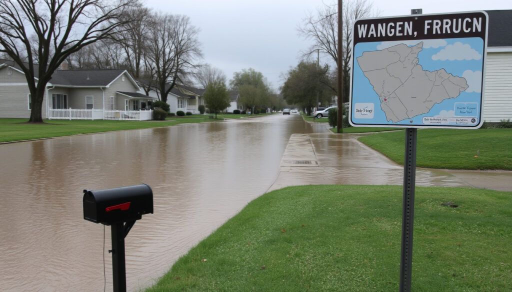
When floodwaters forced families from their homes in Selwyn Huts before dawn on 1 May 2025, the district’s emergency plan shifted from theory to reality: by 5:39 AM, a state of local emergency was declared, giving civil defence teams authority to coordinate evacuations and close roads. For anyone living in a flood-prone area of Selwyn, the event carried a clear message: knowing the right contact and the nearest escape route can make all the difference.
Selwyn State of Emergency — What You Need to Know
State of emergency declared: 1 May 2025, 5:39 AM ·
State of emergency lifted: 1 May 2025, 3:00 PM ·
Contact number: 0800 SELWYN (735 996) ·
Primary hazard: Flooding from heavy rain ·
Evacuations: Selwyn Huts
Quick snapshot
- Call 0800 SELWYN (735 996) (Selwyn District Council guidance)
- Contact Selwyn Civil Defence team via this number (Selwyn District Council guidance)
- Report issues — flooding, road hazards, at-risk neighbours (Selwyn District Council guidance)
- Rising river levels triggered the emergency (RNZ reporting)
- Selwyn Huts evacuated (RNZ reporting)
- Flood maps on council website (RNZ reporting)
- Declared 1 May 2025, 5:39 AM
- Lifted 1 May 2025, 3:00 PM
- Can be re-declared if conditions worsen
- Selwyn Gets Ready programme
- Register for civil defence alerts
- Household emergency kit recommended
Six key facts summarise the operational timeline and the response structure.
| Fact | Detail |
|---|---|
| Declaration Date | 1 May 2025, 5:39 AM |
| Lifting Date | 1 May 2025, 3:00 PM |
| Contact Number | 0800 SELWYN (735 996) |
| Primary Hazard | Heavy rain, rising rivers, localised flooding |
| Evacuation Area | Selwyn Huts |
| Lead Agency | Selwyn Civil Defence Emergency Management |
What is the current state of emergency in Selwyn?
Why was a state of emergency declared?
- Heavy rain caused rivers to rise rapidly, threatening residential areas in the Selwyn River catchment (New Zealand Gazette, official government notice).
- Environment Canterbury flood controllers advised the council that rising river levels posed a high risk to life and property (Selwyn District Council, local emergency management authority).
- Access to the Selwyn Huts community was at risk of being cut off (RNZ, public broadcaster).
When a river rises fast enough to threaten homes and roads, the legal mechanism that unlocks coordinated response is a state of local emergency under the Civil Defence Emergency Management Act 2002. That is what the Selwyn District Council invoked at 5:39 AM on 1 May 2025. The declaration gave authorities the power to evacuate residents, close roads, and direct resources to the hardest-hit areas without waiting for standard council processes.
When did the state of emergency start and end?
- Declared: 1 May 2025, 5:39 AM (New Zealand Gazette, official government notice).
- Lifted: 1 May 2025, 3:00 PM, after river levels receded and the immediate threat passed.
The implication: the entire emergency phase lasted about nine and a half hours. That is short for a state of emergency, but the speed of the river rise — driven by what The New Zealand Herald (national newspaper) described as Christchurch Airport’s fourth-wettest day on record — meant the danger window was compressed. The pattern: fast-onset flooding requires equally fast activation of emergency powers.
Selwyn’s emergency declaration lasted under ten hours, but the speed of the river rise — fuelled by more than 80 mm of rain — meant residents had little time to react. The window for safe evacuation can close before many people realise they are at risk.
How can I contact Selwyn emergency services?
What is the official emergency phone number?
- Call 0800 SELWYN (0800 735 996) to report flooding, road hazards, or at-risk neighbours (Selwyn District Council, local emergency management authority).
- For life-threatening or immediate flooding danger, call 111 and ask for Fire and Emergency (Selwyn District Council safety guidance).
Which organisations should I contact?
- Selwyn Civil Defence Emergency Management team — reachable via 0800 SELWYN.
- Selwyn Response team may be activated during large-scale events to coordinate on-the-ground assistance.
- Canterbury Civil Defence provides regional coordination and updates.
The trade-off: 0800 SELWYN is the right first call for non-life-threatening issues, but if you are facing rising water around your home, do not wait — dial 111. The council’s archived guidance makes this distinction explicit because minutes can matter when floodwaters are climbing.
Where can I get a flood map for Selwyn?
Are there online maps showing flood risk?
- Selwyn District Council provides flooding and coastal hazards maps showing areas at risk from a 200-year flood event (Selwyn District Council (local emergency management authority)).
- Canterbury Civil Defence also publishes regional hazard information.
What areas were most affected?
- Selwyn Huts — evacuated due to the threat of being cut off by the Selwyn River (Newstalk ZB (national radio news)).
- Te Waihora / Lake Ellesmere area, especially Leeston and Doyleston, suffered severe surface flooding (1News (national news outlet)).
- Multiple road closures were active — including Malvern Hills Road, Auchenflower Road, Coes Ford, Springs Road, and Old Tai Tapu Road — during the peak of the event (Selwyn District Council (local emergency management authority)).
What this means: the flood maps are a planning tool for the 200-year event, but the May 2025 flooding showed that even areas outside the mapped extreme-risk zone can face rapid inundation. Residents should check the council maps, then consider whether their local roads and access routes are vulnerable to heavy rain, regardless of the official flood zone.
The Selwyn River can rise faster than many residents expect. In the May 2025 event, the threat to access roads escalated overnight, leaving residents of Selwyn Huts with a narrow window to self-evacuate. Check river levels early — do not wait for an official order.
What preparations should Selwyn residents make?
How can I stay informed during emergencies?
- Register for emergency alerts through Canterbury Civil Defence channels.
- Monitor the Selwyn District Council website and Facebook page for real-time updates.
- Listen to local radio stations (RNZ, Newstalk ZB) for official announcements.
- Check the NZTA Road Closures Map: How to Check Real-Time Status (2025) for live road conditions before travelling.
What emergency kits and plans are recommended?
- Selwyn Gets Ready is the district’s community preparedness programme — it provides resources for household planning.
- Prepare a grab bag with essentials: water, food, medications, phone charger, warm clothing, important documents.
- Have a household emergency plan that includes evacuation routes, a meeting point, and contact numbers for family members.
- Review the Severe Thunderstorm Watch Boxing Day: Safety Guide for additional severe-weather preparation steps.
- Build a grab bag with water, food, medications, a phone charger, warm clothing, and important documents.
- Write a household emergency plan that names evacuation routes, a meeting point, and family contact numbers.
- Register for Canterbury Civil Defence alerts and save 0800 SELWYN (735 996) in your phone before the next storm.
The catch: a plan is only useful if you have practised it. The May 2025 event gave residents of Selwyn Huts roughly zero notice before evacuation was advised. Knowing your nearest safe route without relying on GPS — which may lose signal or show flooded roads — is the difference between a calm exit and a scramble.
Who is responsible for emergency management in Selwyn?
What is the role of Selwyn Civil Defence?
- Selwyn Civil Defence Emergency Management team leads the local response during emergencies.
- They coordinate evacuations, road closures, welfare support, and public communications.
- During the May 2025 event, Civil Defence volunteers worked alongside emergency services to help evacuate residents (RNZ, public broadcaster).
What is the Selwyn District Council doing?
- The council declares states of emergency under the Civil Defence Emergency Management Act 2002 when large-scale events threaten life and property.
- It coordinates with Canterbury Civil Defence and the National Emergency Management Agency for regional and national support.
- It maintains flood maps, road closure systems, and public communication channels for residents.
The pattern: local councils hold the legal power to declare emergencies, but the actual response is a partnership between the council, regional civil defence, and national agencies. Residents should treat the council as the single source of truth for local updates — but also understand that calling 111 remains the right move for immediate danger.
Timeline of the Selwyn flooding emergency
- 1 May 2025, early morning — Heavy rain causes rising river levels in Selwyn District.
- 1 May 2025, 5:39 AM — State of local emergency declared (New Zealand Gazette (official government notice)).
- 1 May 2025, morning — Evacuations ordered for Selwyn Huts (RNZ, public broadcaster).
- 1 May 2025, 3:00 PM — State of emergency lifted after river levels receded.
- Ongoing — Residents can still report issues via 0800 SELWYN (735 996).
Why this matters: the timeline shows how fast a flooding event can escalate. From the first heavy rain to the declaration was a matter of hours. For residents, the signal to watch is not the official declaration — it is the rain forecast and the river level.
What is confirmed and what remains unclear
Confirmed facts
- State of local emergency declared at 5:39 AM on 1 May 2025 (New Zealand Gazette (official government notice)).
- State of emergency lifted at 3:00 PM on the same day.
- Contact number is 0800 SELWYN (735 996) (Selwyn District Council, local emergency management authority).
- Evacuations occurred at Selwyn Huts due to rising rivers (RNZ, public broadcaster).
- Multiple road closures were active during the event (Selwyn District Council, local emergency management authority).
What’s unclear
- Exact number of affected properties beyond Selwyn Huts.
- Future possibility of another state of emergency — depends on weather patterns.
- Duration of recovery efforts for flooded homes and roads.
The pattern: the core facts of the emergency declaration and response are well documented by official sources. What remains uncertain is the broader impact on properties outside the known evacuation zone and the long-term recovery timeline. Residents should assume that any future heavy rain event could trigger a similar response, and prepare accordingly.
“To report issues, call 0800 SELWYN (735 996).”
— Canterbury Civil Defence spokesperson, announcement on Facebook about the lifting of the state of emergency
“A State of Emergency may be declared in large-scale events. Contact members of the Selwyn Civil Defence Emergency Management team.”
— Selwyn District Council emergency management team, website guidance
“A state of emergency was declared for Canterbury’s Selwyn district and evacuations at Selwyn Huts were underway.”
— RNZ Morning Report, 1 May 2025
For residents of Selwyn District, the 1 May 2025 flooding event was a test of the emergency system that passed in under ten hours. The declaration was swift, the evacuations were targeted, and the contact line worked. But the narrow window between the first heavy rain and the decision to evacuate Selwyn Huts is a warning for anyone living near a river in this district. The choice is clear: save the 0800 SELWYN number in your phone now, check the flood maps before the next storm, and have a grab bag ready. Residents who wait until the water rises have waited too long.
selwyn.govt.nz, selwyn.govt.nz, indiannews.nz, healthychristchurch.org.nz, selwyn.govt.nz
Frequently asked questions
What does a state of emergency mean for Selwyn residents?
It gives the council and civil defence the legal authority to evacuate areas, close roads, direct resources, and restrict access to affected zones. Residents must follow official instructions during a state of emergency.
How long can a state of emergency last in New Zealand?
Under the Civil Defence Emergency Management Act 2002, a state of local emergency can last up to seven days, but it can be extended if needed. The Selwyn event lasted about nine hours.
What are the main flood risks in Selwyn District?
The Selwyn River and its tributaries can rise rapidly during heavy rain, threatening low-lying communities like Selwyn Huts, Leeston, and Doyleston. Surface flooding is also a risk in areas around Te Waihora / Lake Ellesmere.
Can I still leave my home during a state of emergency?
Yes, unless roads are closed or you are in a mandatory evacuation zone. The council advises avoiding non-essential travel during severe weather to keep roads clear for emergency services.
How do I request assistance from the Selwyn Response team?
Call 0800 SELWYN (735 996) to report issues or request welfare support. For life-threatening emergencies, always call 111 first.
What is the Selwyn Gets Ready programme?
It is a community preparedness initiative run by the Selwyn District Council, offering resources and guidance on how to plan for emergencies, build a grab bag, and stay informed.
Is the 0800 SELWYN number operational 24/7?
During active emergencies, the number is staffed around the clock. Outside emergencies, it may route to council offices during business hours. For immediate danger, always call 111.
Where can I find official updates on Selwyn emergency situations?
The Selwyn District Council website and Facebook page are the primary sources, along with Canterbury Civil Defence and the National Emergency Management Agency. Local radio stations also broadcast official announcements.
The FAQs above compress the operational essentials: the 0800 SELWYN contact line, the council flood maps, and the Selwyn Gets Ready programme are the three tools residents need before the next storm.
More related posts
 Steak and Cheese Pie Recipe NZ: Classic Kiwi Bakery Style
 Blue Jays vs Yankees: Head-to-Head, Rivalry & Odds (2026)
 How to Choose a Paint Color: Step-by-Step Guide for 2025-2026
 The Warehouse Lower Hutt: Hours, Address & Online Shopping
 New World Mt Roskill: Hours, Phone, Online Shopping & More
 New Zealand Dollar to Sri Lankan Rupee: Live Rate & Conversions
 Gluten Free Pastry NZ: Where to Buy & Recipes